
In response to the humanitarian crisis in the Occupied Palestinian Territory (oPt), OCHA is coordinating relief efforts in Gaza, in cooperation with the United Nations Relief and Works Agency for Palestine Refugees in the Near East (UNRWA) and other partners.
RedR Australia is providing surge capacity to OCHA through remote deployments, which are purposefully funded by the United Kingdom’s Foreign, Commonwealth and Development Office (FCDO).
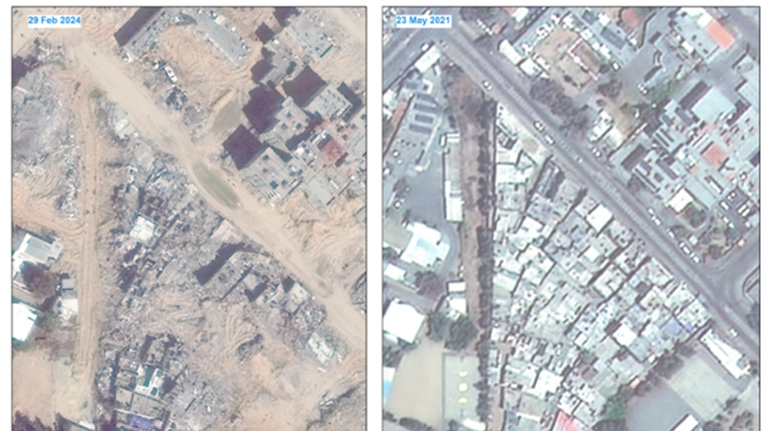
Automated mapping tools improve aid efficiency
RedR Australia roster member Rod has been providing technical mapping support for OCHA’s oPt office. Rod was able to effectively complete his role remotely from Australia.
Rod is a practising engineer who has regularly used geographic information systems (GIS) throughout his career to support a wide range of projects. He has found these GIS skills to be highly transferrable to the humanitarian context. With more than 15 years’ experience working in professional services firms in Australia, he also has experience working in humanitarian GIS and data management for the World Health Organization and OCHA.
To support OCHA’s response to the current Gaza crisis, Rod developed an automated mapping tool using Esri mapping software.
“As new satellite imagery becomes available, a whole suite of maps can be automatically generated by this tool,” explained Rod.
“Quite quickly, information can be seen visually: where the people are moving, where informal shelters are appearing, where they're disappearing, as well as damage to buildings. It allows for rapid visualisation as the situation changes.”
Alongside maps showing the movement of people and damage to buildings, Rod also created maps showing damage to health facilities, such as hospitals.
Teams across OCHA are now using this mapping tool to gain a clearer understanding of how humanitarian needs are changing and inform their decision-making.
The need for mapping skills in humanitarian response
In a volatile and changing humanitarian crisis such as in Gaza, Rod’s mapping skills have been highly valued. His role was technical and included online and static map production, as well as developing and troubleshooting code for automation tools.
“I was helping to maintain OCHA's ArcGIS Online mapping system and producing mapping products using ArcGIS Pro,” said Rod.
“I was also providing remote technical support with how to use the software. I've found that being able to use the ArcGIS/Esri suite of software has been a particularly in-demand skill in emergency responses in recent years. And with the increasing practice of hosting data online, this can often be performed remotely.”
Rod also explained that UN agencies are using this software more and more, and he encourages those with GIS mapping skills to consider supporting humanitarian responses.
“It requires quite a specific technical knowledge. And quite a few people—at many engineering and environmental consultancies, for example—would have that knowledge to quite a high degree.”
Sharing knowledge and building stronger systems
Rod describes his time with OCHA as a sharing of complementary skills.
“For example, the GIS people already in OCHA—the long-term staff—they have a strong understanding of the people working on the ground and the maps they need. ‘What should we map? How should we map it?’ They would know much better than me,” said Rod.
“But I was able to provide support with the more technical aspects of the mapping tools,” he said. “And there were some technical aspects where I could help upskill people in the field.”
He felt he learnt a lot from his colleagues. “Many of them have worked for the UN system for their whole career, while I've worked in private consultancy in Australia. So we had some very complementary skills to exchange,” said Rod.
Developing the skills to respond effectively
Early in his career, Rod worked in Pakistan as an engineer where he saw up close the need for humanitarian and disaster-relief work. Coming home to Australia, he found his mapping skills developed to support his regular role as a consulting engineer.
After completing RedR Australia’s training courses, including the WASH course, the Essentials of Humanitarian Practice course and the Personal Safety and Security course (now known as the HEAT course), Rod joined the RedR Australia roster.
“I had that desire to help partly because of my previous experience in Pakistan,” said Rod. “And then mapping turned out to be my most useful skill at that time in a humanitarian context.”
Rod has since completed multiple deployments with UN agencies, drawing on his skills in GIS and information management.
He says his experience in professional services firms has given him expertise which is useful in a humanitarian context.
“It’s having the analytical mind frame. It’s also that data focus and having a strong basis in analytical tools, Excel and coding,” he said.
While Rod joined the RedR Australia roster as a water, sanitation and hygiene (WASH) engineer, he admits his skills in GIS and information management are probably more useful now. “Though I'm just happy to use whatever skills I have that are most useful,” he said.
Humanitarian access to the Gaza Strip is currently restricted to just two entry points in the south. Image: OCHA
The power of maps
For humanitarians, maps are invaluable. By gaining accurate information on the humanitarian needs of people affected by the crisis, maps can help humanitarian agencies to better support those in need.
Rod reflected on the impact of GIS software in his recent role.
“What if no GIS software was being used for the Gaza response at all? What would it look like? Well, some aid would still get out there, of course. But it could be far less efficient than it is. GIS allows those on the ground to be able to get in there and direct aid better,” he said.
Learn more about OCHA’s work in the Occupied Palestinian Territory.
References
OCHA (2024) Hostilities in the Gaza Strip and Israel - reported impact | Day 184
The World Bank, the European Union, the United Nations (2024) Gaza Strip Interim Damage Assessment Summary Note - March 29, 2024
World Health Organization (2024) Famine in Gaza is imminent, with immediate and long-term health consequences
